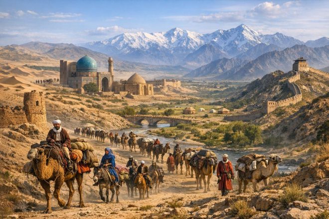
Geographic Framing of the Silk Road in Central Asia
The overland Silk Road was not a singular, linear roadway but rather a dynamic and adaptive network of corridors that connected northern China to the eastern Mediterranean. Its Central Asian segments were shaped decisively by geography, above all by the constraints imposed by deserts, mountains, and river systems. These constraints did not merely limit movement; they structured it, channeling caravans through predictable arteries while simultaneously allowing for variation in route selection. Merchants, envoys, pilgrims, and soldiers moved within a system that combined environmental determinism with human improvisation.
In Central Asia, this network traversed the arid basins of the Tarim, skirted the imposing Tien Shan and Pamir mountain systems, and linked chains of oasis settlements that functioned as logistical, political, and cultural nodes. Each of these nodes had a degree of autonomy, yet none operated in isolation. Seasonal weather patterns—including winter closures of mountain passes, spring flooding in river valleys, and summer heat in desert regions—played a decisive role in shaping itineraries. At the same time, security conditions, including the presence of banditry or the expansion of imperial authority, altered the calculus of risk for merchants. Political control could redirect entire flows of commerce, privileging certain pathways while marginalizing others.
The Silk Road in this sense is best understood not as a route but as a system of negotiated spaces. Geography established the possibilities, but political structures and market incentives determined which of those possibilities were realized at any given moment.
Exit from Northern China to the Tarim Basin
The departure points for many Silk Road journeys lay in the imperial capitals of northern China, most prominently Chang’an during the Han and Tang periods. From these centers, caravans and official missions proceeded northwestward into the Hexi Corridor, a narrow and strategically vital strip of land bounded by the Qilian Mountains to the south and the Gobi Desert to the north. This corridor functioned as both gateway and bottleneck, concentrating movement into a space that could be monitored and controlled by imperial authorities.
The significance of the Hexi Corridor lay not only in its geography but also in its administrative infrastructure. Fortified garrison towns, watchtowers, and beacon systems formed an integrated security network that enabled rapid communication across distances. Signals transmitted via fire or smoke could alert authorities to threats or announce the arrival of caravans. This system reduced uncertainty, thereby lowering transaction costs for those operating under imperial protection.
At the western terminus of the corridor lay Dunhuang, a crucial pivot point in the Silk Road network. Here, caravans made fundamental strategic decisions about their onward routes. The immense Taklamakan Desert, one of the largest shifting sand deserts in the world, rendered direct crossings impractical. Instead, two principal circuits emerged: a northern route skirting the Tien Shan foothills and a southern route tracing the base of the Kunlun Mountains. Each route followed a chain of oasis settlements sustained by meltwater from surrounding highlands.
The choice between these routes depended on several factors, including political stability in adjacent regions, the availability of water and forage, and existing commercial partnerships. In periods when northern routes were exposed to nomadic incursions, traders might favor the southern passages, and vice versa. Thus, the bifurcation at Dunhuang was not merely geographical but strategic, reflecting a broader system of risk management.
Oasis Networks and Caravan Logistics
The oasis cities of the Tarim Basin—Turfan, Kucha, Khotan, among others—formed the backbone of Silk Road logistics. These were not passive waystations but active centers of production, exchange, and governance. Their agricultural systems relied on sophisticated irrigation techniques, including underground channels known as qanats, which allowed communities to cultivate crops in otherwise inhospitable environments.
These oases supported specialized forms of production that contributed to long-distance trade. Khotan, for example, was renowned for its jade and silk production, while Turfan became a center for viticulture and textile manufacturing. Such goods were not merely consumed locally but entered broader exchange networks, linking regional economies to transcontinental flows.
Caravan logistics were complex and required careful coordination. Merchants rarely traversed the entire Silk Road themselves. Instead, goods were transferred between different groups across segments of the network. Local intermediaries played essential roles in this process. They provided fresh pack animals, arranged guides familiar with terrain and water sources, and extended credit to facilitate transactions. These intermediaries often belonged to merchant diasporas that maintained transregional connections, enabling the flow of information as well as goods.
Legal and fiscal frameworks varied widely across the oasis polities. Tariffs, tolls, and tribute obligations were common, reflecting both revenue extraction and mechanisms of control. Safe-conduct documents, seals, and official endorsements were essential for minimizing delays and ensuring passage through regulated territories. In many cases, the authority of these documents depended on the broader political context, including the relative strength of imperial or local rulers.
Religious institutions played a significant logistical and cultural role within these oasis networks. Buddhist monasteries, in particular, served as centers of hospitality, offering lodging to travelers and maintaining repositories of texts and wealth. Their presence contributed to the relative safety and predictability of certain routes, while also facilitating the transmission of religious ideas across linguistic and cultural boundaries.
Crossing High Mountain Corridors
Beyond the Tarim Basin, the Silk Road entered regions defined by high mountain systems, including the Tien Shan, Pamirs, and associated ranges. These mountains did not constitute a single barrier but rather a series of corridors and passes that connected different ecological and political zones. The difficulty of traversing these areas cannot be overstated. High altitudes, unpredictable weather, and limited oxygen posed risks not only to humans but also to pack animals.
Routes through these mountains often converged toward key chokepoints, such as those leading into the Fergana Valley or through the Alai and Wakhan corridors. These passages were narrow and easily controlled, making them strategically significant. Control over such chokepoints shifted frequently between nomadic confederations and sedentary states, each seeking to extract tolls or assert dominance.
The political conditions in these mountain regions were frequently fluid. Nomadic groups, including various Turkic and later Mongol polities, exercised influence over large territories but often relied on negotiation rather than permanent occupation. Sedentary states, by contrast, tended to establish fortified positions in valleys and passes. The interaction between these different forms of political organization shaped the security environment of the Silk Road.
Merchants crossing these highland routes needed to adapt to rapidly changing conditions. Caravans were typically smaller in these regions due to the limitations of terrain. The timing of crossings was critical, with narrow windows during late spring and summer offering relatively safer passage. Delays could result in severe consequences, including exposure to snowstorms or landslides.
Transoxiana and Urban Exchange Centers
Once beyond the mountain corridors, traders entered Transoxiana, a region defined by the lands between the Amu Darya and Syr Darya rivers. This area, encompassing cities such as Samarkand and Bukhara, represented one of the most vibrant commercial and cultural zones of the Silk Road. Unlike the oasis cities of the Tarim Basin, which were relatively isolated, the urban centers of Transoxiana were embedded within dense networks of agriculture, trade, and political authority.
Sogdian merchants were particularly influential in this region. They operated as intermediaries across linguistic, cultural, and political boundaries, facilitating exchanges between China, Central Asia, and beyond. Their commercial activities extended far into East Asia, where Sogdian communities established enclaves in major Chinese cities. These merchant networks were characterized by adaptability and trust, often maintained through kinship ties and shared cultural practices.
The markets of Transoxiana were sites of both economic and cultural exchange. Goods arriving from China, including silk, lacquerware, and paper, were exchanged for a wide array of commodities, such as textiles, glassware, metals, and high-quality horses. The Fergana Valley, in particular, was famed for its horses, which were highly valued by Chinese elites.
Urban institutions in Transoxiana supported these exchanges through regulated markets, standardized weights and measures, and legal frameworks governing contracts and disputes. These features contributed to the region’s reputation as a stable and reliable center of commerce, even during periods of broader political fragmentation.
From Central Asia to Iran and the Eastern Mediterranean
The westward extension of Silk Road routes carried goods and people from Transoxiana into the Iranian plateau and further toward Mesopotamia and the eastern Mediterranean. This segment of the network was shaped by the administrative and fiscal systems of major empires, including the Sasanian and later Abbasid states. These polities developed sophisticated mechanisms for regulating trade, including taxation systems and the establishment of urban markets.
Cities such as Merv, Nishapur, and Baghdad served as key nodes in this segment of the network. They functioned not only as commercial hubs but also as centers of intellectual and cultural activity. The integration of overland routes with maritime networks in the Persian Gulf and Red Sea allowed for diversification in trade strategies. Merchants could shift between land and sea routes depending on cost, security, and political conditions.
This flexibility was a defining feature of the Silk Road system. Rather than being constrained to a single path, traders could adapt their routes in response to changing circumstances. The integration of different transport modes enhanced the resilience of the network, allowing it to persist across centuries despite significant political and environmental disruptions.
Political and Security Dynamics
The viability of Silk Road routes through Central Asia depended heavily on political and security conditions. Periods of relative stability, often associated with large empires, facilitated long-distance trade by reducing risks and standardizing regulations. These periods are sometimes described as phases of Pax, during which the costs of transaction and transport were minimized.
However, such stability was rarely uniform or permanent. The fragmentation of political authority could lead to increased tolls, localized conflicts, and heightened risks of banditry. In these contexts, merchants relied on negotiated arrangements with local rulers, tribal leaders, and other power brokers to secure safe passage. Tribute systems, diplomatic marriages, and alliances were all part of this broader framework of negotiation.
Intelligence networks also played a role in maintaining the functionality of the Silk Road. Information about route conditions, political developments, and market prices circulated alongside goods. This flow of information allowed merchants to make informed decisions and adapt to changing circumstances.
Cultural and Religious Transmission
The Silk Road facilitated not only the movement of goods but also the transmission of ideas, beliefs, and technologies. Central Asia served as a key conduit in these processes, linking different cultural zones across Eurasia. Buddhism, for example, spread from the Indian subcontinent into China through the oasis cities of the Tarim Basin. Monasteries along these routes became centers of translation and scholarship, contributing to the adaptation of Buddhist texts into Chinese contexts.
Later, the expansion of Islam across Transoxiana and beyond introduced new religious and cultural dynamics. Islamic institutions, including mosques and madrasas, became integral to urban life in many Silk Road cities. These institutions also facilitated the integration of local communities into broader Islamic networks.
Artistic styles, scripts, and technologies diffused through these interactions. The exchange of motifs in visual art, the adoption of different writing systems, and the spread of technologies such as papermaking illustrate the multidirectional nature of cultural transmission along the Silk Road.
Continuities and the New Silk Road
Contemporary infrastructure initiatives often draw on the historical legacy of the Silk Road to frame their objectives. Projects associated with modern transcontinental connectivity, including rail corridors linking western China to Central Asia and Europe, energy pipelines crossing Kazakhstan and Turkmenistan, and logistics hubs in cities such as Khorgos, reflect patterns that have historical precedents.
These initiatives emphasize efficiency, standardization, and multimodal transport, seeking to reduce the time and cost associated with long-distance trade. At the same time, they are embedded within modern geopolitical contexts that introduce new considerations, including issues of sovereignty, financial dependency, and regional security.
The comparison with historical Silk Road networks should not be overstated. Modern infrastructure operates at vastly different scales and speeds, and is governed by different political and economic systems. Nonetheless, the spatial logic of nodal connectivity and corridor-based movement remains a point of continuity.
Step-by-Step Synthesis of the Central Asian Passage
Movement along the Central Asian segments of the Silk Road followed a sequence shaped by geography and political context. Journeys typically began in the controlled environment of the Hexi Corridor, where imperial infrastructure facilitated organized departure. At Dunhuang, routes diverged around the Taklamakan Desert, forming northern and southern circuits that connected chains of oasis settlements.
These circuits eventually reconverged toward the mountain corridors leading into Transoxiana. The crossing of high-altitude passes represented one of the most challenging stages of the journey, requiring careful timing and adaptation. Upon entering Transoxiana, traders encountered urban markets characterized by institutional stability and commercial sophistication.
From there, routes extended westward into the Iranian plateau and onward to the eastern Mediterranean, integrating with maritime networks and expanding the range of possible destinations. At each stage, the interplay of environmental constraints, political authority, and intermediary networks determined the pace, cost, and direction of movement.
This synthesis underscores the complexity of the Silk Road as a system. It was not defined by a single path or unified authority but by a series of interconnected spaces in which geography and human agency interacted continuously.